About Coxheath
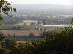
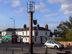
Coxheath is a large village to the south of Maidstone, built on the Greensand Ridge overlooking the Weald of Kent to the south and the Kent Downs to the north. The Greensand Way runs along the ridge on the outskirts of the village. Coxheath is situated to the west of the A229 (Chatham to Maidstone) road and is to be found either side of the B2163 running from Leeds to Teston. Coxheath has a thriving commercial community, based originally on fruit farming. The village boasts a range of shops, a restaurant, a cafe, a primary school, a modern library, a church, a public house, a purpose-built village hall and open spaces for sport and recreation.
Coxheath is twinned with La Seguiniere, a village in the Loire Valley of France.
The Residents Village Hall & Recreation Centre serves as a community centre encouraging a large number of clubs and societies to flourish as well as providing a venue for social events and private parties. Regular activities include youth and adult football, badminton, table tennis, gymnastics, judo, tai-chi, dancing, indoor bowls and bingo. The hall also hosts a well supported preschool group and an active retirement association.
During the Christmas period each year the village centre and surrounding roads are transformed by a display of festive lighting, which has become a feature of this thriving and vibrant community.
A brief history of Coxheath
Coxheath has not always been the village that we know today. In the past, it was described as an elevated plain of waste, or common, land some three miles long and a mile deep. Old maps indicate that men had lived along this ridge since prehistoric times.
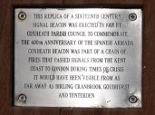
The strategic position of the ridge, 120 metres above sea level, determined its choice as one of the sites in the network of beacons erected in the year of the Armada in 1588. In 1756, Coxheath became a military camp. At this time 12,000 troops were encamped on the heath and Coxheath became the army's largest training ground. George III carried out a review of the army on the heath in 1778, followed by the Duke of York in 1804. It is thought by some that this could be the origin of the nursery rhyme 'The Grand Old Duke of York'.
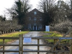
The army encampment at Coxheath came to an end in 1815. It is thought that Clock House was used by officers for the duration of the camp.
In 1771, a workhouse was built in the vicinity of what are now Stockett Lane and Workhouse Lane. However, a new workhouse was built in the Heath Road in 1838. This building was to become known later as Linton Hospital. The days of the workhouse, as such, came to an end in 1929, as the institution evolved into a hospital. A nurses home was built in 1931. This building is now the South East Coast Ambulance Control Centre.
It was not until 1950 that the first housing estate was developed in Coxheath, when approximately 200 houses were built in the Huntington Road area. Several other housing developments followed in the 1960s and 1970s. The expansion of the village meant that Coxheath was able to achieve parish status. Coxheath Parish Council met for the first time on 25th May 1964.


